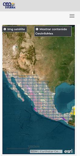
Discover the hidden depths of Mexico with GeoInfoMex, the ultimate geological consultation app. Unleash the power of geoscientific knowledge at your fingertips and delve into the mysterious world beneath your feet. Explore invaluable resources such as geological-mining and geophysical data, geochemical maps, and information about mines, beneficiation plants, and impressive rocks. Gain insight into agrarian nuclei through the National Agrarian Registry and be enchanted by the beauty of CONANP protected natural areas. Stay updated on seismic activities with real-time earthquake information from SSN and IG-UNAM. Additionally, access hydrological data from Cencas and unlock a wealth of knowledge about Mexico's bountiful treasures. GeoInfoMex is your passport to a geological adventure like no other.
Features of GeoInfoMex:
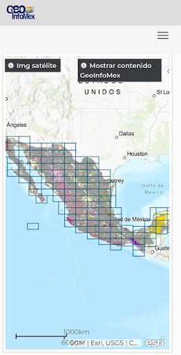
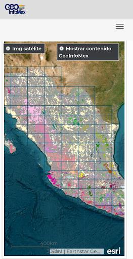
- Comprehensive Geological Information: GeoInfoMex provides users with a wide range of geoscientific, geological-mining, and geophysical information about the Mexican Republic. Users can access detailed maps and data related to geological-mining activities, geophysical studies, and geochemical mapping.
- Mining and Rock Data: The app offers valuable information about mines, beneficiation plants, and sizable rocks in Mexico. Users can explore the location, characteristics, and other relevant details of mining operations and significant rock formations across the country.
- Land Ownership Details: GeoInfoMex includes information about agrarian nuclei (ejidos) from the National Agrarian Registry. Users can obtain information about land ownership, boundaries, and other important data for a better understanding of the landscape.
- Protected Natural Areas: With this app, users can easily access information about protected natural areas managed by the National Commission of Natural Protected Areas (CONANP). Whether you are interested in eco-tourism or nature conservation, this feature provides valuable insights into Mexico's diverse natural landscapes and their importance for biodiversity conservation.
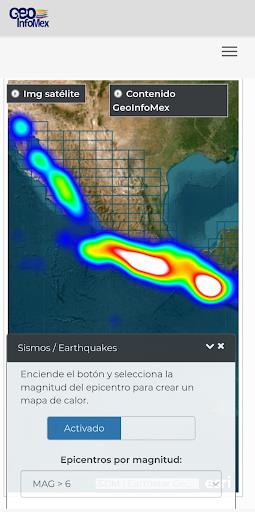
- Earthquake Monitoring: GeoInfoMex integrates earthquake data from reputable sources like the National Seismic Service (SSN) and the Institute of Geophysics at UNAM (IG-UNAM). Users can stay updated with real-time earthquake information, such as seismic events, magnitude, and location, ensuring their safety and awareness.
- Hydrological Data: The app also provides access to hydrological data from the National Water Commission (CNA). Users can explore information related to Cencas hydrological reports, including water resources, river basins, and water quality, allowing them to make informed decisions regarding water management and conservation.
Conclusion:
Whether you are a geoscientist, researcher, environmentalist, or simply curious about Mexico's geology, GeoInfoMex is the go-to app that provides accurate and up-to-date information in an easily accessible format. Click the download button now to explore and discover Mexico's captivating geoscientific landscape!
3.1
2.95M
Android 5.1 or later
gim.pack
GeoInfoMex的功能很强大,数据详尽,但界面设计不是很直观,有时查找信息比较麻烦。如果能优化一下用户体验就更好了。总的来说,值得一试。
GeoInfoMex ist einfach großartig! Die geowissenschaftlichen Daten sind sehr detailliert und leicht zugänglich. Ich kann mir keine bessere App für geologische Forschung vorstellen. Perfekt für jeden, der sich für Geologie interessiert!
J'adore GeoInfoMex! Les données géologiques sont très complètes et bien organisées. La seule chose qui manque, c'est une fonction de partage des découvertes avec d'autres utilisateurs. Sinon, c'est un outil parfait pour les passionnés de géologie.
GeoInfoMex is a fantastic tool for anyone interested in geology! The app's interface is user-friendly, and the data provided is incredibly detailed. I wish there were more interactive maps, but overall, it's a must-have for geoscientists.
GeoInfoMex es útil, pero a veces se siente un poco abrumador con tanta información. Me gustaría que tuviera más ejemplos prácticos o casos de estudio para entender mejor los datos geológicos. Aún así, es una buena herramienta.